Art Atlas & Interactive Map
Overview
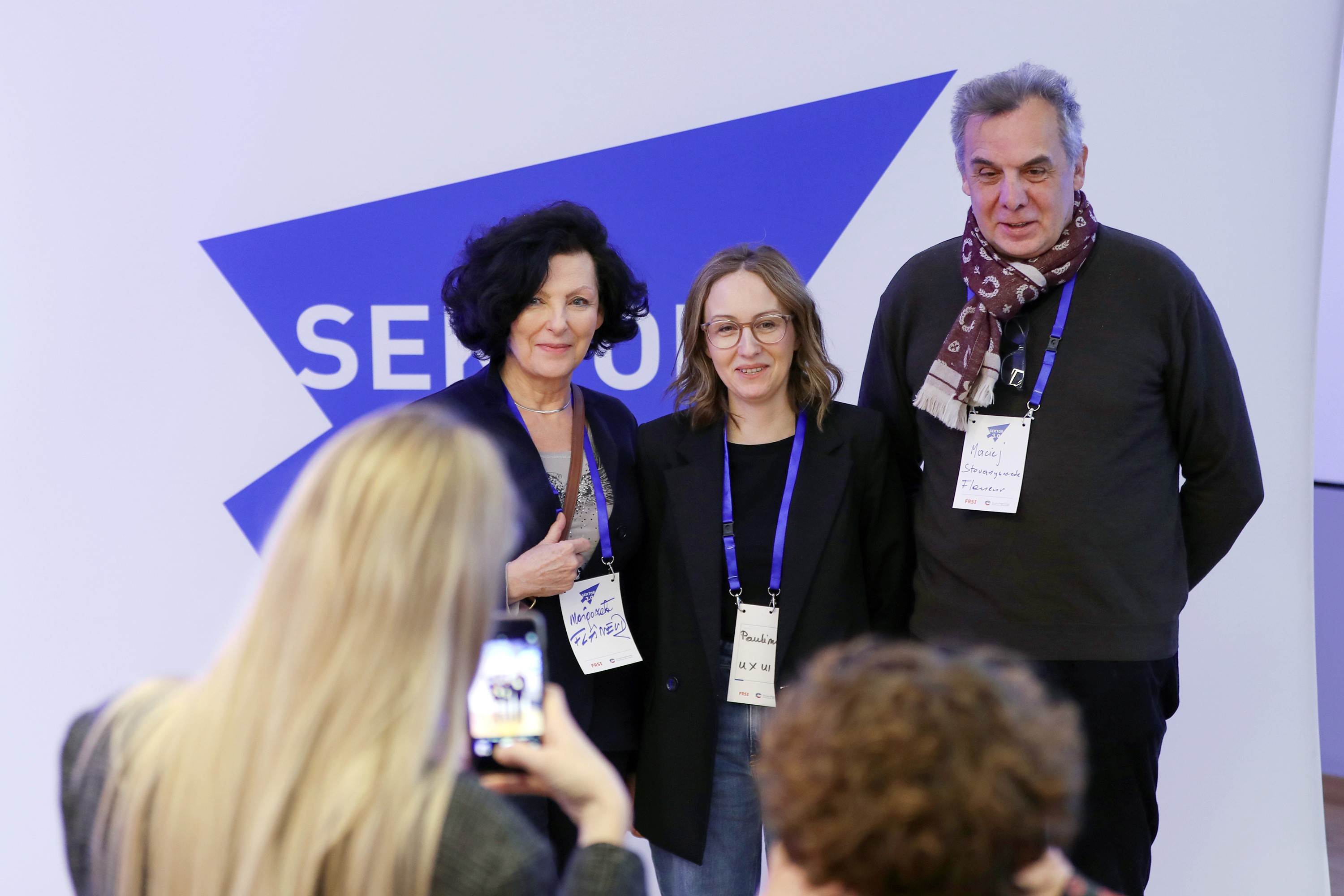
"Oko na sztukę” was a project where I worked as a volunteer Product Designer in collaboration with Sektor 3.0. Together with another Product Designer, I supported Stowarzyszenie Flaneur during the project incubation process. The collaboration included online mentoring sessions and workshops focused on developing the initiative and refining its direction.
The project received funding from Sektor 3.0 as well as support from the Mazovian Voivodeship Conservator of Monuments. Its social impact focused on strengthening local communities and supporting the preservation of local identity and cultural heritage
Categories
Art Atlas & Interactive Map
Web & Mobile App
Client
Sektor 3.0.

Core Problem Statement
We are building a digital tool with two main components:
Catalog: A verified knowledge base of artworks, artists, and technical details. This component relies on institutional resources and expert input.
Interactive Map: A visualization of artwork locations, allowing users to explore the history and context of public art. We plan to co-develop this feature with users—travelers, local heritage enthusiasts, art and culture lovers, history explorers, and investors interested in authentic local stories. Verified data from the map will feed back into the Catalog, ensuring its accuracy and reliability.
Research & Discovery
We prepared the research methodology, an online survey, and interview questionnaires. Data was collected from two sources: the online survey was designed to gather information for the project catalogue, while interviews helped us better understand user needs and shape the survey direction. We also conducted a competitive analysis to identify how our project could stand out from similar initiatives. The MVP assumptions and initial scope were defined by the association.
Define & Strategy
At this stage, we developed business models and defined several key hypotheses regarding how the product would function. During the process, we validated some of the main project assumptions, and it was already becoming clear that there were technical limitations that would ultimately impact the project’s further development.
At the same time, we began exploring alternative technological solutions. One of the main challenges was the financial limitation related to building a custom interactive map. As a result, we started considering solutions based on external APIs as well as integrations and redirections to Google Maps.
Ideation & Design Process
The design process was based on the Design Studio method, which allows teams to quickly generate multiple solution concepts and visualize them through rapid sketches. This approach supports fast exploration of ideas, collaborative inspiration, and identifying the most promising design directions before refining the details.
As part of the collaboration, we participated in workshops organized by Sektor 3.0. During these sessions, each team member prepared their own low-fidelity concepts and screen proposals. We then conducted a quick dot voting session focused on selected features and interface elements, which helped us identify the strongest ideas and combine them into one cohesive low-fidelity website concept.
Final Design
Although we did not develop the final visual design for the project, we created prototypes of the key views using AI-powered tools in Figma and Lovable. These included a homepage prototype, an artwork submission form, and individual artwork pages containing information about the piece, its location on the map, and additional descriptive details.
Even though the prompts were highly detailed, the final visual refinements were completed by my fellow Product Designer. I especially value this collaboration, as it gave us the opportunity to exchange knowledge, share feedback, and support each other throughout the design process.
Testing & Validation
As part of the project, we conducted two online interviews focused on the product vision and its future direction. During these sessions, we also carried out three usability testing tasks, which helped us better understand user needs and identify key areas for improvement.
Based on the gathered insights, we developed a set of design recommendations covering both functionality and user experience:
simplifying role names such as “curator” and “guardian” to make them more intuitive for users,
improving the visibility and placement of the submission form,
placing greater emphasis on the visual layer and increasing the use of imagery related to the project’s theme,
adding user consent for location sharing,
expanding filtering options by year, author, and artistic style,
implementing an interactive map with filters by object type (e.g. mosaic, sculpture, sgraffito) and search by city or district,
introducing a “micro-location” feature with contextual hints such as “behind the building” or “right-side courtyard,”
adding a verification gallery in the detailed view to help users identify artworks in real-world locations,
creating a historical module based on standardized metadata such as creation date, author, and historical context,
implementing a glossary explaining artistic techniques in an accessible way,
introducing a “Last Chance” reporting feature to document the condition of artworks (e.g. “under renovation,” “damaged”), supporting the preservation of disappearing art,
enabling anonymous photo uploads without requiring account creation to reduce entry barriers,
implementing photo versioning to compare how objects looked in the past versus today, creating a digital historical record over time.
Results & Impact
As part of the project, we conducted two online interviews focused on the product vision and its future direction. During these sessions, we also carried out three usability testing tasks, which helped us better understand user needs and identify key areas for improvement.
Based on the gathered insights, we developed a set of design recommendations covering both functionality and user experience:
simplifying role names such as “curator” and “guardian” to make them more intuitive for users,
improving the visibility and placement of the submission form,
placing greater emphasis on the visual layer and increasing the use of imagery related to the project’s theme,
adding user consent for location sharing,
expanding filtering options by year, author, and artistic style,
implementing an interactive map with filters by object type (e.g. mosaic, sculpture, sgraffito) and search by city or district,
introducing a “micro-location” feature with contextual hints such as “behind the building” or “right-side courtyard,”
adding a verification gallery in the detailed view to help users identify artworks in real-world locations,
creating a historical module based on standardized metadata such as creation date, author, and historical context,
implementing a glossary explaining artistic techniques in an accessible way,
introducing a “Last Chance” reporting feature to document the condition of artworks (e.g. “under renovation,” “damaged”), supporting the preservation of disappearing art,
enabling anonymous photo uploads without requiring account creation to reduce entry barriers,
implementing photo versioning to compare how objects looked in the past versus today, creating a digital historical record over time.
Reflections
The project was carried out within a very limited timeframe, which required building the product almost entirely from scratch. One of the key challenges was validating hypotheses against real user needs while balancing them with the project’s technological and organizational constraints.
This experience helped me develop many new skills across research, strategy, and collaborative design work. One of the most challenging aspects for me was maintaining the team’s energy and engagement throughout the process of defining problems and building hypotheses.
The project also showed me how important the role of a Product Manager is within the design process. The absence of someone responsible for prioritization, process organization, and strategic team guidance became especially noticeable during decision-making and maintaining alignment throughout the project.
Art Atlas & Interactive Map
Overview
"Oko na sztukę” was a project where I worked as a volunteer Product Designer in collaboration with Sektor 3.0. Together with another Product Designer, I supported Stowarzyszenie Flaneur during the project incubation process. The collaboration included online mentoring sessions and workshops focused on developing the initiative and refining its direction.
The project received funding from Sektor 3.0 as well as support from the Mazovian Voivodeship Conservator of Monuments. Its social impact focused on strengthening local communities and supporting the preservation of local identity and cultural heritage
Categories
Art Atlas & Interactive Map
Web & Mobile App
Client
Sektor 3.0.
Core Problem Statement
We are building a digital tool with two main components:
Catalog: A verified knowledge base of artworks, artists, and technical details. This component relies on institutional resources and expert input.
Interactive Map: A visualization of artwork locations, allowing users to explore the history and context of public art. We plan to co-develop this feature with users—travelers, local heritage enthusiasts, art and culture lovers, history explorers, and investors interested in authentic local stories. Verified data from the map will feed back into the Catalog, ensuring its accuracy and reliability.
Research & Discovery
We prepared the research methodology, an online survey, and interview questionnaires. Data was collected from two sources: the online survey was designed to gather information for the project catalogue, while interviews helped us better understand user needs and shape the survey direction. We also conducted a competitive analysis to identify how our project could stand out from similar initiatives. The MVP assumptions and initial scope were defined by the association.
Define & Strategy
At this stage, we developed business models and defined several key hypotheses regarding how the product would function. During the process, we validated some of the main project assumptions, and it was already becoming clear that there were technical limitations that would ultimately impact the project’s further development.
At the same time, we began exploring alternative technological solutions. One of the main challenges was the financial limitation related to building a custom interactive map. As a result, we started considering solutions based on external APIs as well as integrations and redirections to Google Maps.
Ideation & Design Process
The design process was based on the Design Studio method, which allows teams to quickly generate multiple solution concepts and visualize them through rapid sketches. This approach supports fast exploration of ideas, collaborative inspiration, and identifying the most promising design directions before refining the details.
As part of the collaboration, we participated in workshops organized by Sektor 3.0. During these sessions, each team member prepared their own low-fidelity concepts and screen proposals. We then conducted a quick dot voting session focused on selected features and interface elements, which helped us identify the strongest ideas and combine them into one cohesive low-fidelity website concept.
Final Design
Although we did not develop the final visual design for the project, we created prototypes of the key views using AI-powered tools in Figma and Lovable. These included a homepage prototype, an artwork submission form, and individual artwork pages containing information about the piece, its location on the map, and additional descriptive details.
Even though the prompts were highly detailed, the final visual refinements were completed by my fellow Product Designer. I especially value this collaboration, as it gave us the opportunity to exchange knowledge, share feedback, and support each other throughout the design process.
Testing & Validation
As part of the project, we conducted two online interviews focused on the product vision and its future direction. During these sessions, we also carried out three usability testing tasks, which helped us better understand user needs and identify key areas for improvement.
Based on the gathered insights, we developed a set of design recommendations covering both functionality and user experience:
simplifying role names such as “curator” and “guardian” to make them more intuitive for users,
improving the visibility and placement of the submission form,
placing greater emphasis on the visual layer and increasing the use of imagery related to the project’s theme,
adding user consent for location sharing,
expanding filtering options by year, author, and artistic style,
implementing an interactive map with filters by object type (e.g. mosaic, sculpture, sgraffito) and search by city or district,
introducing a “micro-location” feature with contextual hints such as “behind the building” or “right-side courtyard,”
adding a verification gallery in the detailed view to help users identify artworks in real-world locations,
creating a historical module based on standardized metadata such as creation date, author, and historical context,
implementing a glossary explaining artistic techniques in an accessible way,
introducing a “Last Chance” reporting feature to document the condition of artworks (e.g. “under renovation,” “damaged”), supporting the preservation of disappearing art,
enabling anonymous photo uploads without requiring account creation to reduce entry barriers,
implementing photo versioning to compare how objects looked in the past versus today, creating a digital historical record over time.
Results & Impact
As part of the project, we conducted two online interviews focused on the product vision and its future direction. During these sessions, we also carried out three usability testing tasks, which helped us better understand user needs and identify key areas for improvement.
Based on the gathered insights, we developed a set of design recommendations covering both functionality and user experience:
simplifying role names such as “curator” and “guardian” to make them more intuitive for users,
improving the visibility and placement of the submission form,
placing greater emphasis on the visual layer and increasing the use of imagery related to the project’s theme,
adding user consent for location sharing,
expanding filtering options by year, author, and artistic style,
implementing an interactive map with filters by object type (e.g. mosaic, sculpture, sgraffito) and search by city or district,
introducing a “micro-location” feature with contextual hints such as “behind the building” or “right-side courtyard,”
adding a verification gallery in the detailed view to help users identify artworks in real-world locations,
creating a historical module based on standardized metadata such as creation date, author, and historical context,
implementing a glossary explaining artistic techniques in an accessible way,
introducing a “Last Chance” reporting feature to document the condition of artworks (e.g. “under renovation,” “damaged”), supporting the preservation of disappearing art,
enabling anonymous photo uploads without requiring account creation to reduce entry barriers,
implementing photo versioning to compare how objects looked in the past versus today, creating a digital historical record over time.
Reflections
The project was carried out within a very limited timeframe, which required building the product almost entirely from scratch. One of the key challenges was validating hypotheses against real user needs while balancing them with the project’s technological and organizational constraints.
This experience helped me develop many new skills across research, strategy, and collaborative design work. One of the most challenging aspects for me was maintaining the team’s energy and engagement throughout the process of defining problems and building hypotheses.
The project also showed me how important the role of a Product Manager is within the design process. The absence of someone responsible for prioritization, process organization, and strategic team guidance became especially noticeable during decision-making and maintaining alignment throughout the project.



Book a call, and I’ll take care of the rest
Book a call, and I’ll take care of the rest
Book a call, and I’ll take care of the rest